ok, Sensei :nag:
What is wrong
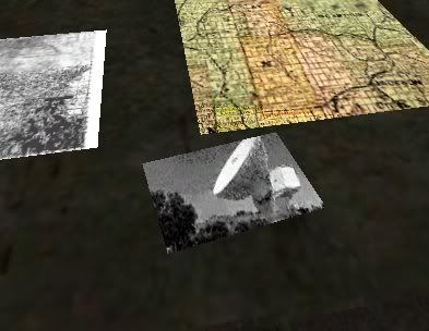
The map that is showing up underneat the satellite photos is actually a modified board_c03 that has a custom map on it; the problem is, why in gods name is it behind that? It is pretty much tiling, quite terribly, the satellite photo and underlaying a completely different texture.
With photos of what I hoped it would look like and what it did look like in the original post.
Exactly how you got to that point
I didn’t specifically point out what I did, I made a brush, I put a texture on it; I left that out to save redudancy.
What you have tried to do to fix it
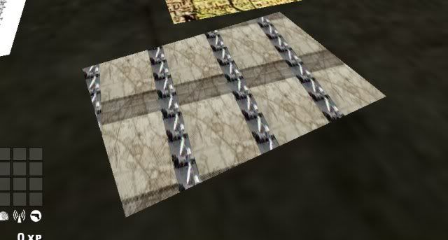
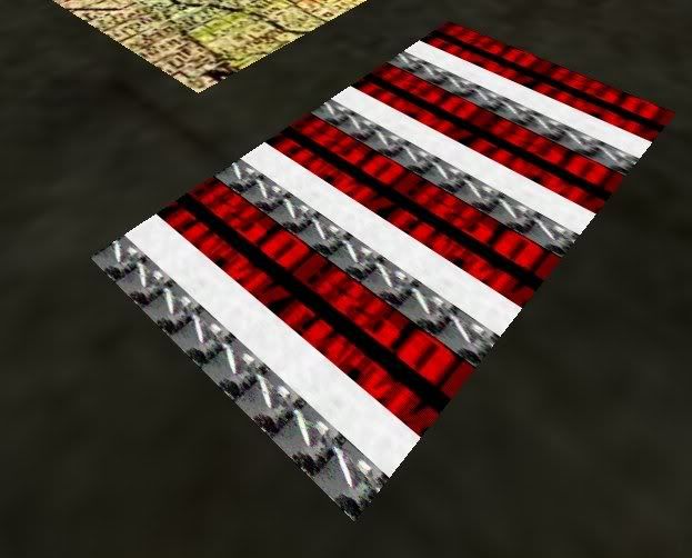
I took the angle out, doesn’t work. I tried 128x128 for the texture size, original was 128 x 256.
A little further investigation proved that for no apparent reason, it does the same thing with a different satellite photo just thrown onto a brush, nothing special - just a random picture fitted to 256x128 and put on a brush. It did the same exact thing this one is doing. However, between the time I tried that and had this problem, I placed a bunch of papers on a desk and they had no problems aligning properly.
What you are trying to achieve.
I posted a picture of what I had hoped it would look like.
Maybe you need to add in a few more points so that you can understand my problem. Any more specific and I would have posted the solution. Now you can call me rude. Perhaps you could, kindly, not reply to any more of my threads. Enjoy your party.